In early December of 1941 a large fleet of Japanese ships was in the waters north of the Hawaiian Islands. The six aircraft carriers had departed from the Kuril Islands on November 26 and it took them more than a week to travel the 3,700 miles to reach the sprawling archipelago. The Japanese had made a naval base of a natural harbor in the Kuril Islands, which like the Hawaiian Islands are formed by volcanoes. Japan, the Kurils, the Aleutians, like many of the islands that ring the Pacific Ocean, are the mounts of volcanoes that form where the Pacific plate subducts under other plates at its eastern and northern boundaries. The Hawaiian Islands are also formed by the tops of volcanoes, but of different origin.
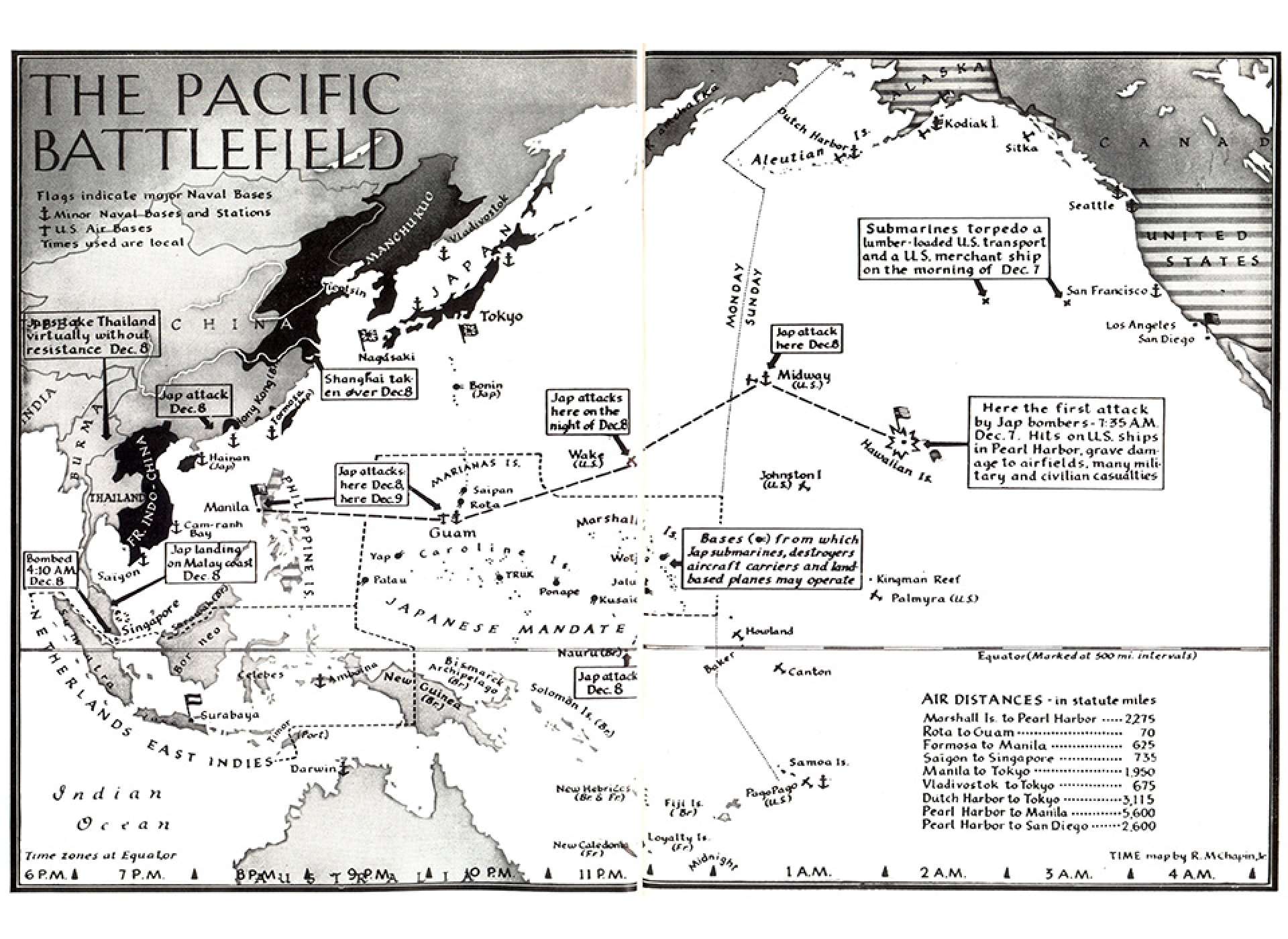
A map published in Time Magazine on December 15, 1941 shows the attacks by Japanese forces on Pearl Harbor and other locations. Image from the Education Collection of The National WWII Museum.
Under the Pacific plate is a hotspot of magma (liquid rock) activity. As the Pacific Plate drifts northeast, and those eastern and northern boundaries melt under other plates and form volcanoes there, the hotspot also forms volcanoes in the middle of the plate. From Midway Island in the northeast to the island of Hawaii in the southeast, this chain of islands spans from youngest to oldest. The volcanoes form, with lava unique to the spot, and the hot rock cools in the ocean until giant mountains are formed. On the Big Island, Hawai'i, is Mauna Kea, a million-year-old volcano that crests at almost 14,000 feet above the sea. Mauna Loa is also on Hawaii, and is only 135 feet lower than Mauna Kea. Mauna Loa is still active, unlike its near neighbor, and 700,000 years old. The lava of these oceanic volcanoes is more fluid than that from the volcanoes on the edges of the plate. Because of the more fluid lava, the volcanoes here are more likely to form shield-like mounds, and erupt with more flowing of lava than explosions of ash and rock. The ocean around the Hawaiian Islands is deep, up to 16,000 feet. Including their subterranean slopes, Mauna Loa and Mauna Kea are about 30,000 feet from base to summit.
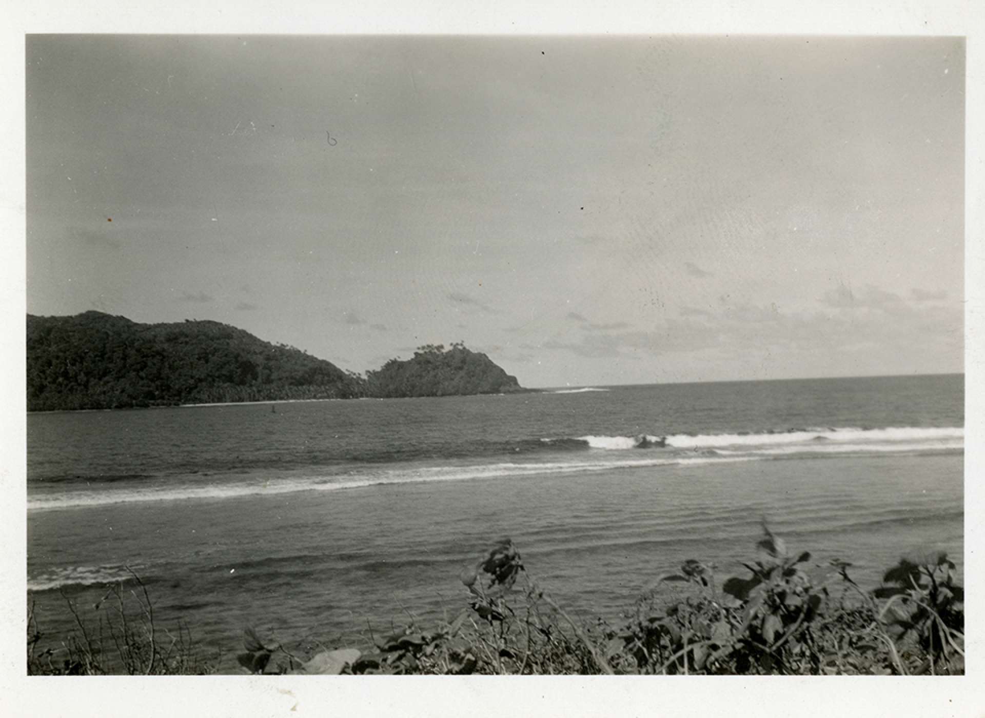
A view across a bay to a cove, Hawaii, July 1941. The National WWII Museum, Gift of Jane Schlaht, 2011.124.119.
To see the future of the Big Island and its volcanoes, we can look across the archipelago. The island chain extends all the way towards the Kuril Islands in that direction, getting older as you travel from southwest to northeast, back to where the six Japanese carriers embarked. Maui, Lanai, and Molokai are the next oldest islands; Maui and Lanai are about 1.5 million years old, and Molokai 1.9 million years old. The highest point in these islands is Haleakala at about 10,000 feet. Oahu (where Pearl Harbor is) is about 3 million years old, and Kauai is about 5 million years old. On both of those islands, instead of prominent peaks, there are ridges of mountains, at 4,000 feet high on Oahu and 5,000 feet on Kauai. All of these islands, from Hawaii to Kauai are known as the Leeward Islands.
Older, and farther to the northeast, are a string of island remnants, the Windward Islands. They are the ancient marks of past volcanic activity in the area, stretching from Nihoa to Midway and Kure Atolls. The entire range of the Hawaiian Island from Hawai'i to Kure stretches 1,700 miles. The volcanic mountains weather in the rain and wind of the Pacific, forming rich soils. Over very long periods these soils also weather and are carried by rivers and streams to the ocean, as the island shrinks back into the waves. The oldest islands are gone, leaving only the rings of corals that lived on the underwater slopes of the volcanic mountains. These atolls eventually erode away too, leaving little trace of their existence. The atolls of Kure and Midway are about 30 and 28 million years old, respectively.
As the Japanese fleet of carriers traveled towards younger and younger islands in the chain, they approached Oahu, their target, their pilots readied themselves. Three hundred and sixty planes headed toward Pearl Harbor, intending to arrive around 8:00 a.m. local time. First they flew over many miles of ocean, with the fleet far enough away to avoid detection. The first sight of Oahu, as they came from the north, would have been green peaks rising from the sea.
Oahu is shaped roughly like a diamond. Its two original volcanoes have eroded away to leave parallel ridges on the east and west of the island with a valley in the center. The north shore of the island has few harbors, and lots of cliffs. Pearl Harbor is a deep cleft on the south shore of the island, with an islet in its waters. This harbor had been jealously protected by the United States for over a century. Much of the interest in the island chain for Americans was this harbor, strategically important for both commercial and military purposes as it was located near the midpoint of the Pacific Ocean.
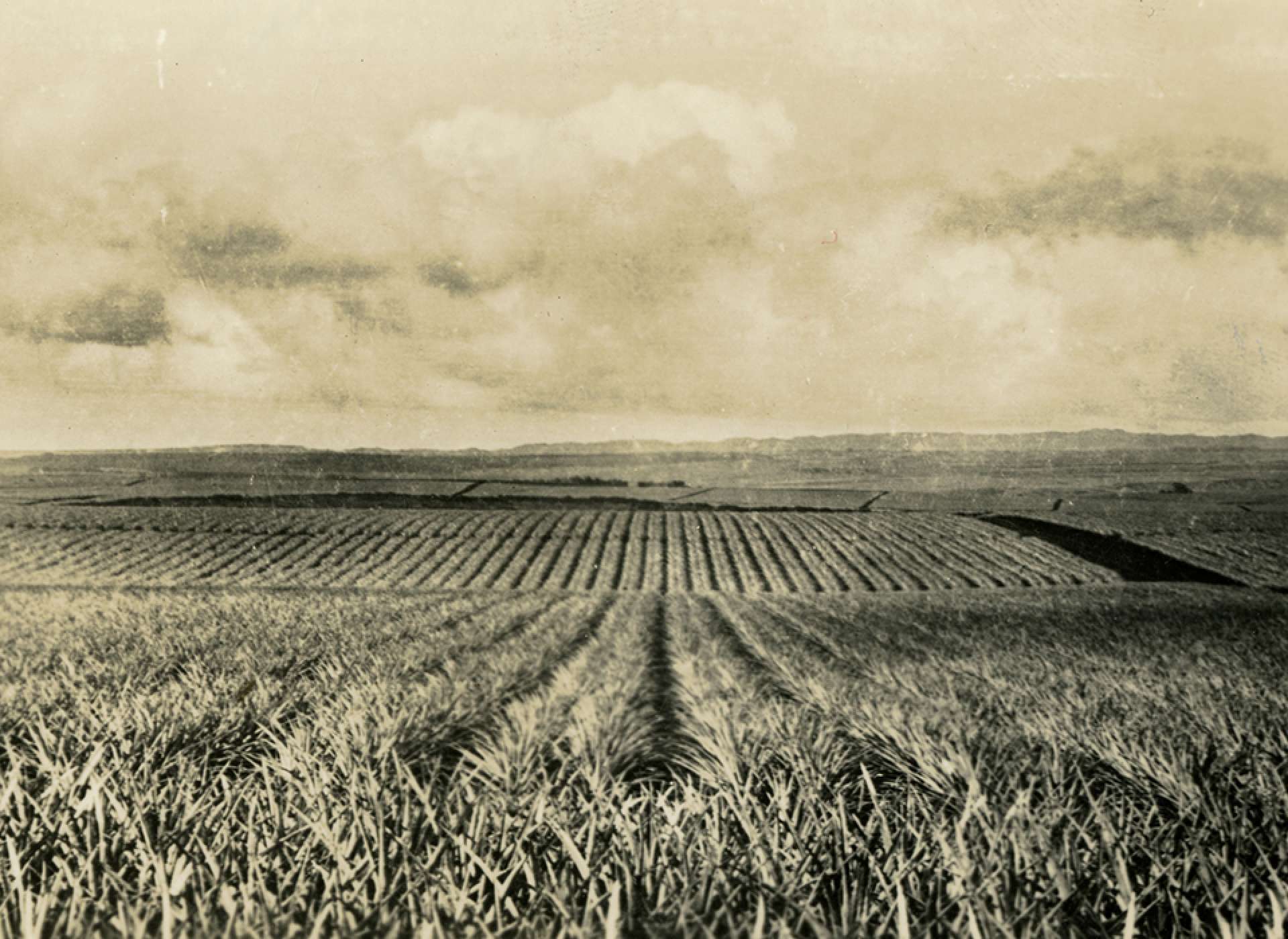
Pineapple Fields, Hawaii, November 1945. The National WWII Museum, Gift of Patricia L. Harrach, 2002.536.119.
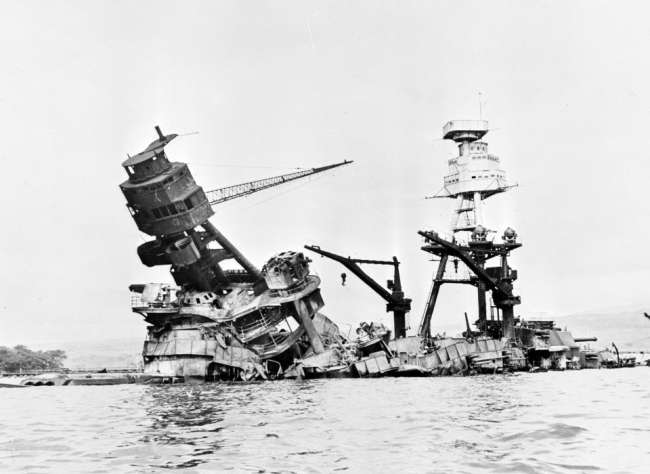
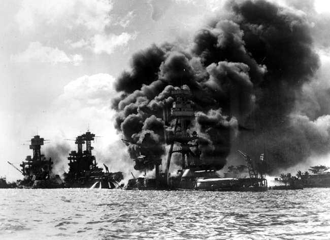
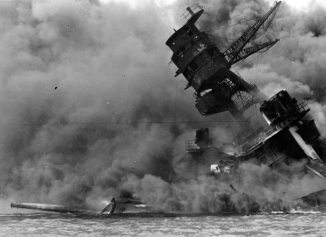
The fighters and bombers coming south from their carriers split into three groups when they arrived at Oahu. One group followed the west coast, another the east, and the third came down the valley between them. This group would have seen agricultural activity interspersed with the wet forests of the valley. Like many of the other islands, US companies had sugar cane, pineapple, and other plantations on Oahu. Native Hawaiians, and immigrants from Japan, worked these fields for the outsider farming companies. The planes converged from their three paths, bringing destruction to the ships and airfields of Pearl Harbor, before returning to the carriers to refuel and come again in a second wave.
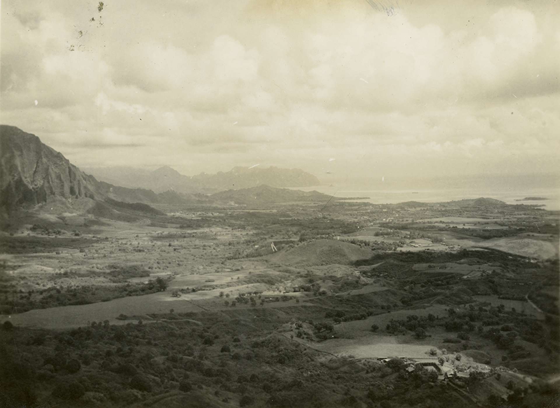
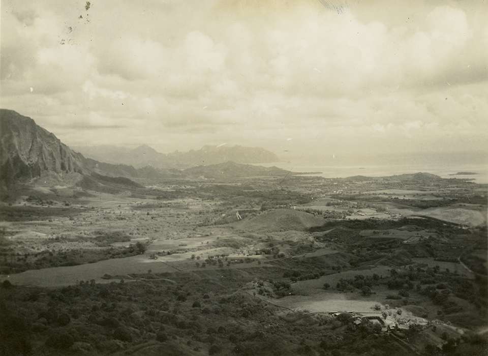
View from Pali Pass of the central valley on Oahu, 1945. The National WWII Museum, Gift of Patricia L. Harrach, 2002.536.073
Also arriving that morning were five Japanese submarines. They had left from a port in Japan on November 25, and by 1:00 a.m. on December 7, they were 12 miles from the entrance to Pearl Harbor. From each of these larger submarines embarked midget submarines, which made their way to the harbor and the shores of Oahu. These small submarines were armed with torpedoes, but were much less effective than their aerial counterparts. Some of these ran aground in the rough waters and rough shores, others were spotted and destroyed.
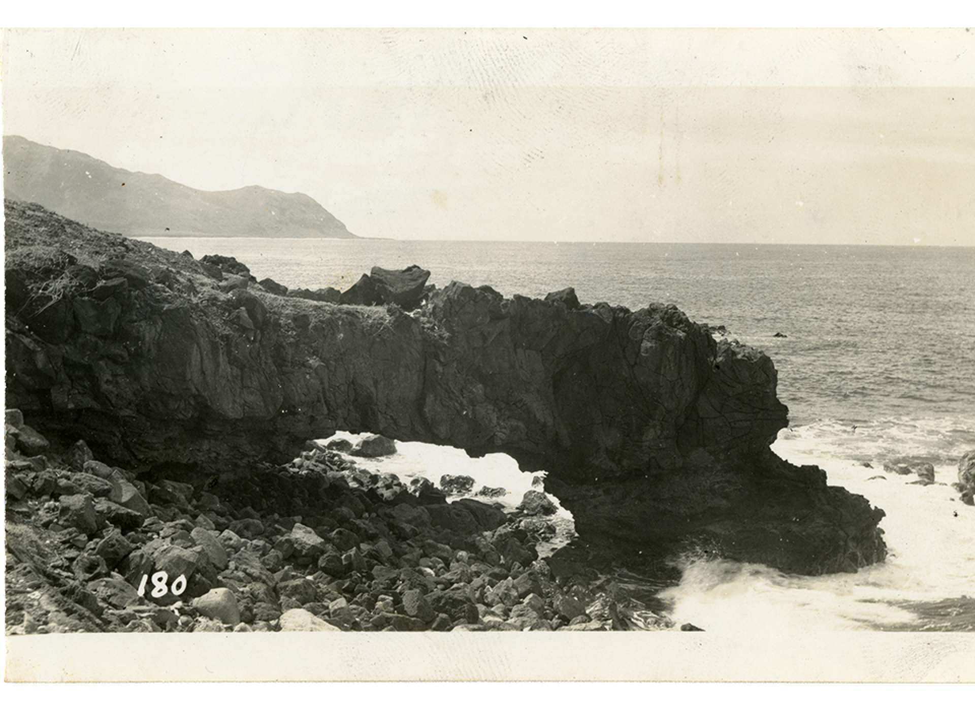
A natural arch formed on the rocky coastline, November 1945. The National WWII Museum, Gift of Patricia L. Harrach, 2002.536.098.
Our understanding of the geology of the Hawaiian Islands is much more recent than World War II. Cold War era technologies and research led to the discoveries of continental and oceanic plates, plate subduction, magma hotspots, and the theory of Plate Tectonics. The entire Pacific Campaign was shaped by the ponderous movement of these plates; the islands hopped to victory were formed by forces little understood at the time. The exotic Pacific that charmed and challenged troops was mysterious in cultural and geologic ways. The fruits of wartime technological developments led to the explanation of the geology of the region.
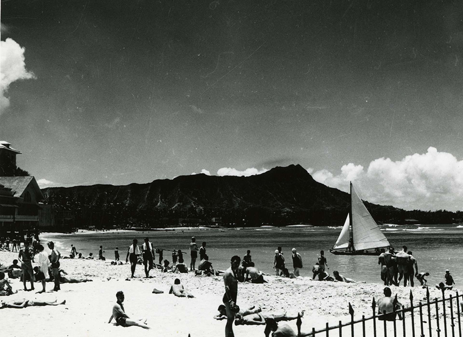
Sunbathers on Waikiki beach, Diamondhead in background. Honolulu, Hawaii, no date. The National WWII Museum, Gift of Patricia L. Harrach, 2009.365.178.
The attack on Pearl Harbor brought the United States into World War II. It verified the American belief in the strategic importance of the islands. Over the decades since the war, agriculture has declined in economic importance on the islands, with tourism taking its place. The Naval presence on the island is still prominent. Eruptions of Kilauea as recently as May 2021 show that the forces which formed the archipelago are still in action. Eruptions off the coast of the Big Island, 19 miles from the shore where Kilauea is, remind us that these islands will keep forming at one end of the chain, and disappearing into the sea at the other, far into the future.
Rob Wallace
Rob runs teacher workshops and develops curriculum, including Real World Science, funded by The Northrop Grumman Foundation.
Cite this article:
MLA Citation:
APA Citation:
Chicago Style Citation: