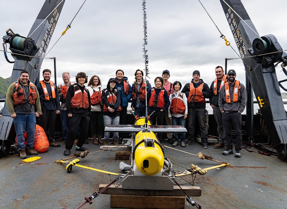
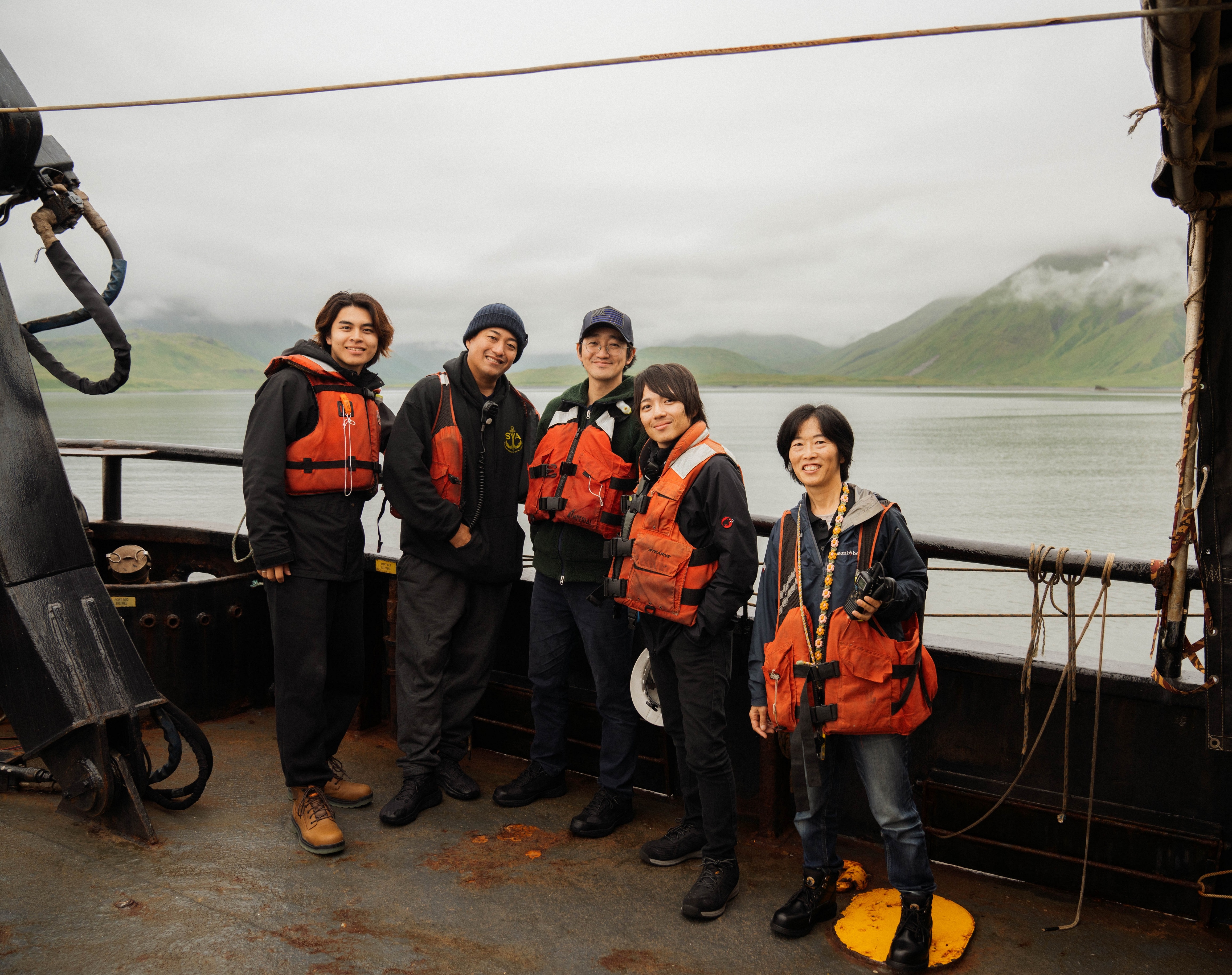
Top Photo: Members of the Exploring Attu’s Underwater Battlefield and Offshore Environment expedition aboard the Norseman II off Attu. Courtesy of Exploring Attu’s Underwater Battlefield and Offshore Environment.
In July 2024, a multinational research team ventured to the waters off the Aleutian Island of Attu in search of remaining traces of the often-overlooked WWII battlefield hidden beneath the waves. With a $707,000 grant from National Oceanic and Atmospheric Administration in 2022, East Carolina University’s Program in Maritime Studies created the Exploring Attu’s Underwater Battlefield and Offshore Environment expedition under the leadership of Assistant Professor of Maritime Studies Jason Raupp, PhD, and doctoral student Dominic “Dom” William Bush. They were joined by 12 other researchers, including two members of the local Aleut population, five researchers from the contiguous United States, and five Japanese researchers and equipment specialists. Together, this team of 14 men and women from around the world set out to the remote reaches of the far north to document the submerged cultural heritage of the recently established Aleutian Islands WWII National Monument.
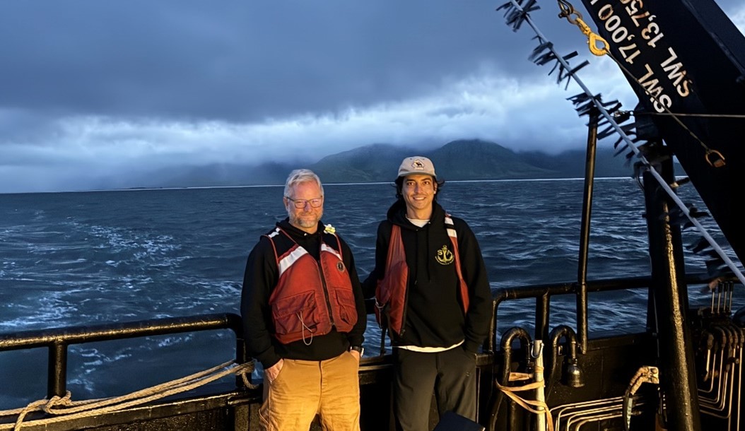
Jason Raupp, PhD, and Dominic “Dom” William Bush off Attu. Courtesy of Exploring Attu’s Underwater Battlefield and Offshore Environment.
Initially slated to take place in the summer of 2023, the one-year delay allowed for additional funding from the National Park Service’s American Battlefield Protection Program as well as an increase in both personnel and equipment. ThayerMahan provided the team with their new SeaScout Synthetic Aperture Sonar system, relatively recent technology developed for underwater archaeological expeditions. The World Scan Project and Blue Robotics provided two new low-cost remote operated vehicles (ROVs) and underwater drones to capture live footage of wrecks and other artifacts discovered on the seafloor, further enhancing the expedition’s capabilities. All this technology was backed up by archival research carried out by Bush, who Raupp described as carrying out an “impressive” dive into the reports and photographic documentation of ships, giving the team concentrated search zones for their upcoming expedition.
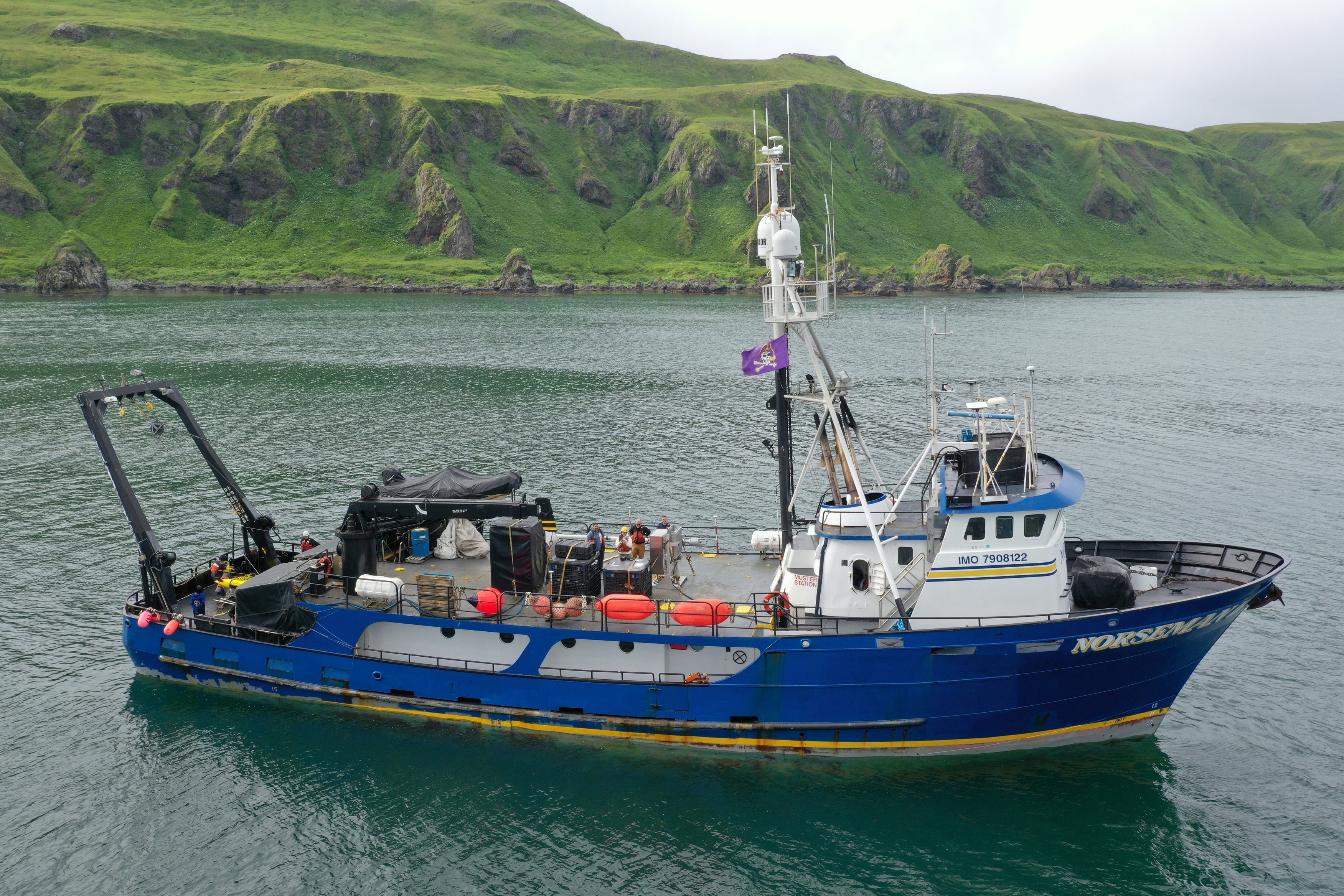
The Norseman II off Attu. Courtesy of Bobbi Hornbeck, Exploring Attu’s Underwater Battlefield and Offshore Environment.
When it came time to sail to Attu in July, the researchers were based aboard the storied research vessel Norseman II, the same ship used by Project Recover to locate the sunken stern of USS Abner Read off Kiska in the summer of 2018. According to Raupp, the Norseman arrived off the island right around dawn, and witnessing the “stark beauty of the place” was “a pretty spectacular feeling.” Bush agreed: “When you get there … what you see is pretty much what the troops saw. … Being able to see the physical terrain in person was pretty surreal. … It’s impossible to realize how formidable the terrain was until you get there.” Beyond the treeless windswept mountains of Attu, a nearby NOAA trawling ship recovered a section of wartime aircraft skin from an American torpedo bomber around the start of the expedition’s operations, further emphasizing the amount of unexplored and well-preserved remains from World War II lie in wait in Attu’s waters.
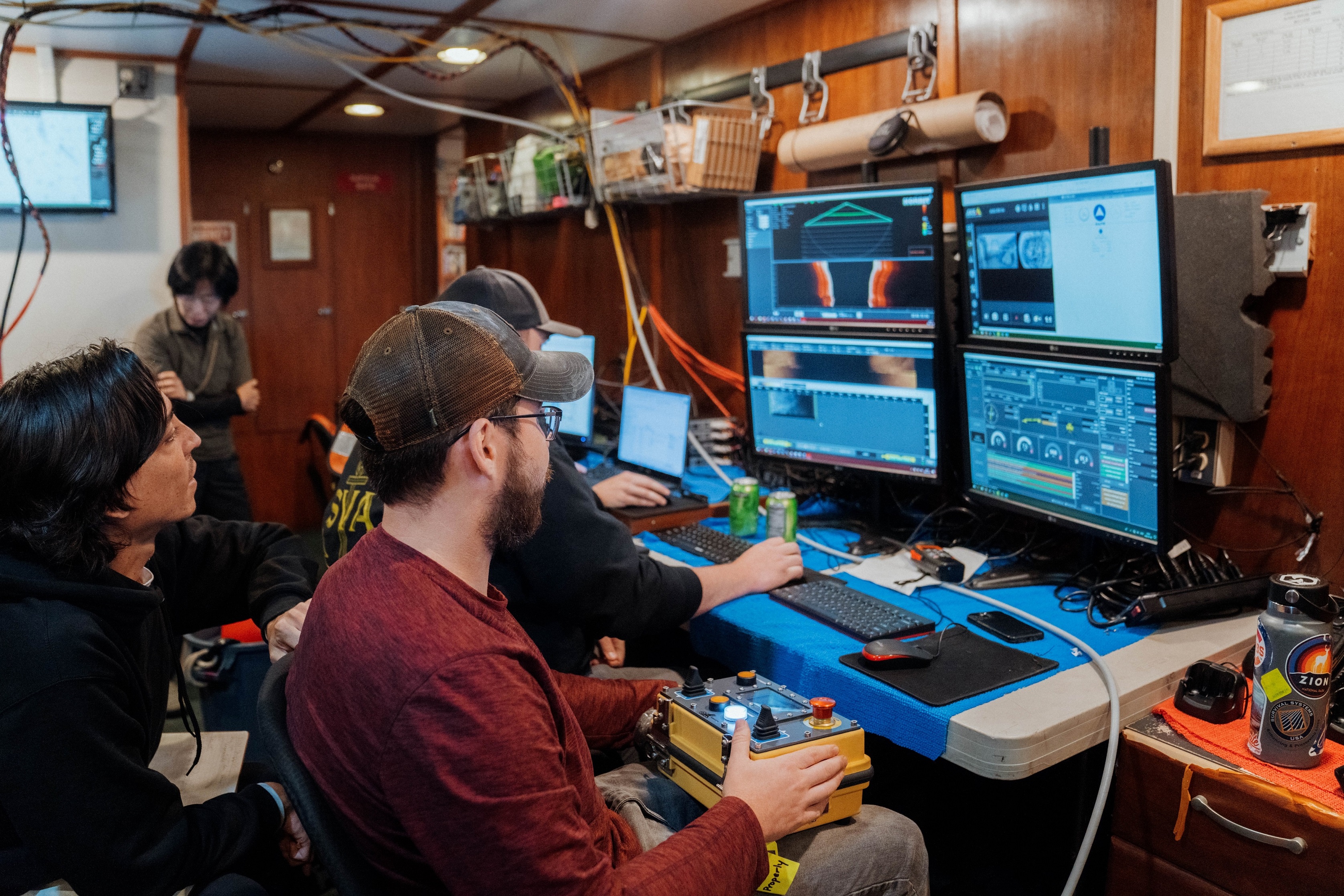
Expedition members using the SeaScout sonar system in search of the lost wrecks. Courtesy of Ryo Fukaya, Exploring Attu’s Underwater Battlefield and Offshore Environment.
The expedition discovered the wrecks of the Cheribon Maru, Kotohira Maru, and USAT Dellwood, all of which had not been seen since the 1940s. Drawing on Bush’s archival research to establish a search grid, the “centimeter” resolution of the new sonar scans allowed the team to archive extreme levels of detail on their passes without having to resort to invasive methods. Once a wreck was located, the team’s drone helped spot and guide the ROV as it descended to take video and images of each site.
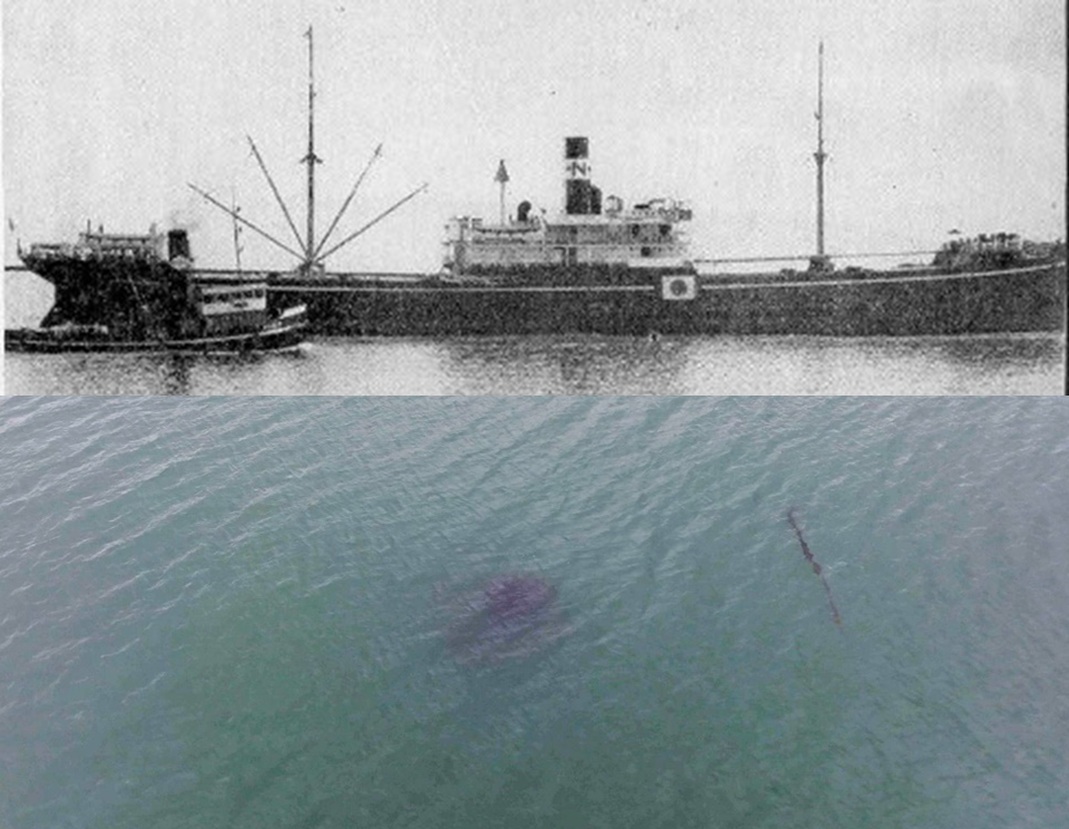
Top: Wartime recognition image of the Cheribon Maru. Courtesy of the US Navy. Bottom: An aerial view of the wreck as seen by the expedition drone; the coloration is a kelp concentration on the hull. Courtesy of Yasumasa Ichikawa, World Scanning Project.
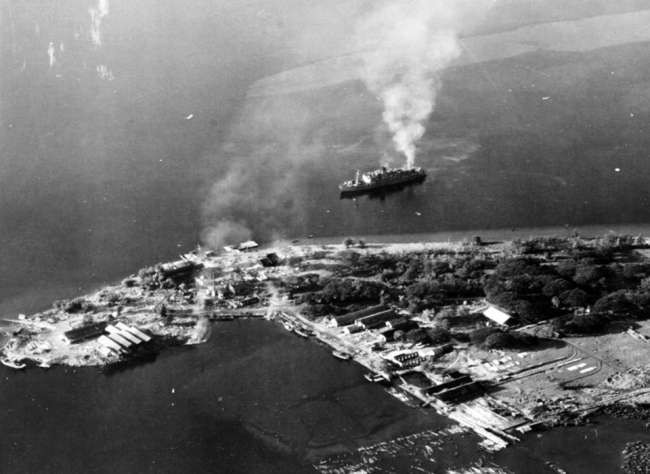
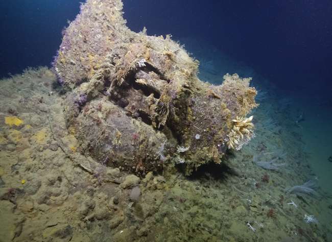
On November 26, 1942, an American aircraft spotted the Japanese cargo ship Cheribon Maru a little over 300 yards from Attu’s shore in Holtz Bay. An attack by four B-26 Marauders and their four P-38 escorts set the vessel afire, with the wreck eventually settling into the bay. The Cheribon Maru disappeared beneath the waves for nearly 82 years before being rediscovered by the expedition around 30 feet below the surface of Holtz Bay. Covered in kelp and marine life, the wreck blended in with the blue-green waters on the ROV footage, with some protruding materials hinting at what lay beneath the thriving ecosystem.
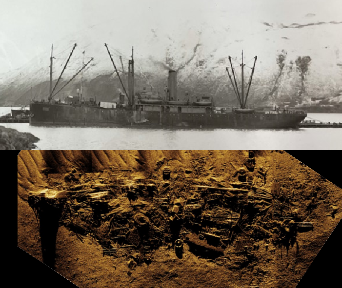
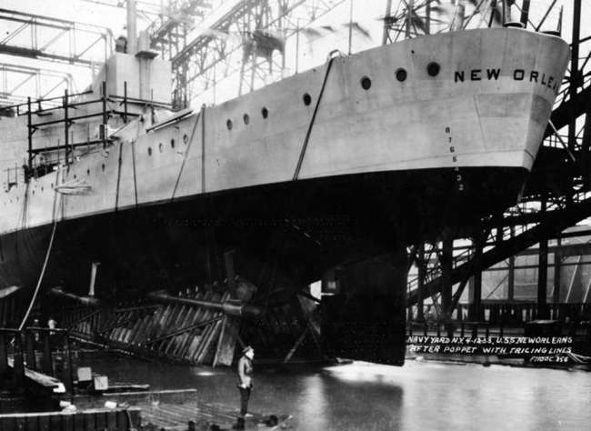
Top: Wartime image of the Dellwood in the Aleutians. Courtesy of the National Archives. Bottom: Composite sonar scan of the wreck. Courtesy of ThayerMahan Inc.
On the opposite side of Attu lies Massacre Bay, the site of the main American landings during the battle to reclaim the island. On July 19, 1943, the cable layer USAT Dellwood was bound for this important anchorage from the island of Shemya when the vessel suddenly ran aground on an “underwater pinnacle” roughly three miles from shore. Her crew abandoned the vessel as she sunk in 100 feet of water, remaining there until the ship became a navigational hazard and had to be broken up. The expedition team rediscovered the Dellwood on July 19, 2024—exactly 81 years after her grounding. New sonar scans showed the damage caused by her destruction, while passes with the ROV captured footage revealed a much more visible wreck than that of the Cheribon Maru, to the point that the Dellwood’s distinctive cable winch was locatable. The most intact wreck, however, was still farther off Holtz Bay.
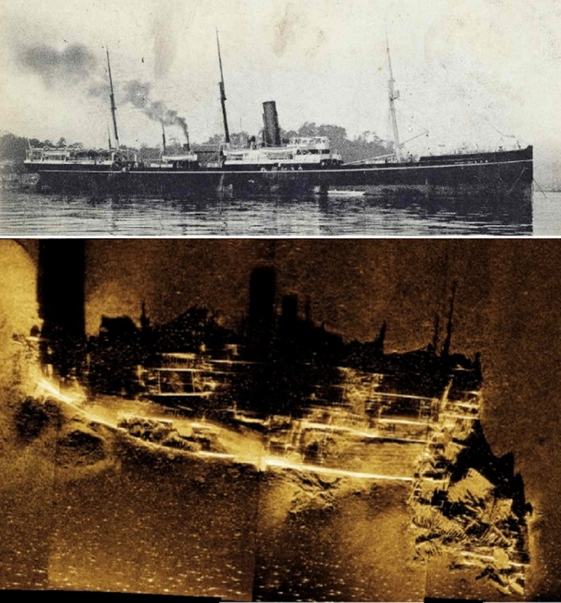
Top: Wartime postcard of the Kotohira Maru. Courtesy of the Yamato Museum. Bottom: Composite sonar scan of the wreck. Courtesy of ThayerMahan Inc.
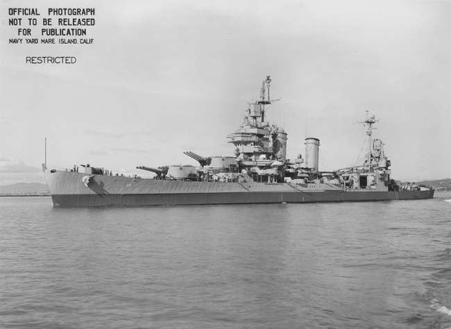
The Japanese cargo ship Kotohira Maru was caught two miles off Holtz Bay by B-24 Liberators while trying to reprovision the Japanese garrison on Attu on January 5, 1943. Struck by a 500-pound bomb to her bow and a second bomb amidships, the vessel sank in inky black waters roughly 300 feet deep. Using reports from the American pilots as a starting point, the expedition team found the wreck of the Kotohira Maru roughly half a mile from the estimated coordinates of her destruction. Passes by sonar revealed a remarkably intact ship sitting on her keel, her bow blown off in an explosion and additional damage amidships just as the American aircrews had documented 81 years before. Bush stated that “seeing photos of the bombs being dropped [on the Kotohira Maru in 1943] and then the sonar images… putting them all together was very satisfying.” Direct examination by the ROV further illustrated the ship’s level of preservation, with her lines and equipment visible amid numerous Plumose Anemones.
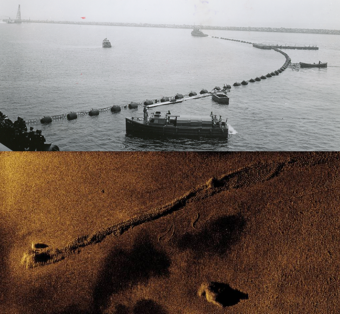
Top: Wartime view of the Massacre Bay submarine nets. Courtesy of the National Archives. Bottom: Composite sonar scan of a net section. Courtesy of ThayerMahan Inc.
These were not the expedition’s only discoveries, however. In their sweeps of the harbors, the team also located more military artifacts such as submarine nets, moorings, equipment, and even a construction vehicle. The team hopes to use the collected sonar and visual data from these sites to create three-dimensional models for the materials and vessels. Both Japanese ships are considered war graves, and such renderings would allow for the preservation of their memories and offer a reexamination of their fates from eight decades in the past. Additionally, Bush and Raupp hope to return to the Aleutians for a coastal survey of Attu and other islands of the campaign. Their July 2024 expedition succeeded in identifying the wrecks of the Marus and the Dellwood, but as their other passes in the bays showed, there is still much from the Aleutians Campaign lying forgotten beneath the waves.
The ROV team members off Attu. Courtesy of Exploring Attu’s Underwater Battlefield and Offshore Environment.

Charles Ross Patterson II
Charles Ross Patterson II is a Curator at The National WWII Museum.
Cite this article:
MLA Citation:
APA Citation:
Chicago Style Citation: